
The IMD issued a "Nowcast" warning, forecasting thunderstorms accompanied by lightning and intense spells of rain with gusty winds reaching 50-60 kmph at isolated places in Mumbai in the next three to four hours.

It has also advanced into most parts of Tamil Nadu, some parts of south interior Karnataka and remaining parts of south Bay of Bengal, according to IMD.

The IMD, in its onset date forecast on May 15, had said the monsoon is likely to hit the southern state on June 5, four days after its normal arrival.

The monsoon this year in India was likely to be 'below normal' at 95% of LPA: Skymet

All sub-regions have been receiving good rainfall except the North-east and east region of the country, where the deficiency has reached 23 per cent.

The weather department said its latest model analysis had indicated that the moist easterly winds in the lower level from the Bay of Bengal would spread to northwest India, covering Punjab and Haryana by July 10, leading to the advancement of monsoon and an increase in rainfall activity over the region, including Delhi, from July 10 onwards.

This year, the monsoon was above normal in almost all parts, except in North-West India, which comprises the major grain producing states of Uttar Pradesh, Punjab, Haryana, Rajasthan, along with states such as Himachal Pradesh, the NCR, Uttarakhand, and J&K.

Southwest Monsoon was vigorous/active over East Rajasthan and the Gujarat region during many days and over West Rajasthan, Konkan and Goa and Madhya Maharashtra on a few days of the week ending July 11.

According to the IMD forecast, monsoon is likely to be normal this year.

After a making a slow progress, the southwest monsoon is expected to gain momentum and advance further into several parts of drought-hit Maharashtra and central India.
Delhi is preparing for its first artificial rain through cloud seeding to combat air pollution. A trial run was successful, and the first rainfall is expected on October 29 if weather conditions are favorable.

After being pummelled by heavy downpours at the start of the week, Mumbai witnessed a brief respite on Tuesday morning, with the island city recording an average rainfall of 106 mm in 24 hours, civic officials said.

Between June 1 and July 28, about 32 per cent of the 685 districts in the country did not receive adequate rainfall.

Delhi is likely to receive the first monsoon showers on June 30 or July 1, India Meteorological Department (IMD) officials said on Tuesday.

'Southwest Monsoon has advanced into remaining parts of Rajasthan, Haryana and Punjab and thus it has covered the entire country today, the 26th June 2020,' the IMD said in its special Daily Weather Report.

This may rescue pulses, cotton and oilseed sowing; rain revival in the south to take longer

Addressing a press conference virtually, India Meteorological Department Director General Mrutyunjay Mohapatra said September was likely to witness normal rainfall in the range of 91-109 per cent of the long period average of 167.9 mm.

According to latest data, crops have been sown in around 72.13 million hectares, which is 8.90 per cent less than the same period last year.

The rains after arriving over Kerala will quickly cover Tamil Nadu and Karnataka, but then might slacken a bit, which could delay its arrival over Northwest India.

"Conditions are favourable for the onset of southwest monsoon over Kerala and its further advance into some more parts of south Arabian sea, remaining parts of Maldives - Comorin area, some parts of Tamil Nadu and some more parts of Bay of Bengal during the next 24 hours," said a statement by the Indian Meteorological Department.

India has received 20 per cent less rainfall since the start of the monsoon period on June 1, with the rain-bearing system making no significant progress between June 12 and 18, according to the India Meteorological Department (IMD).

The southwest monsoon is set to make its exit in style, bringing rains to the parched parts of Uttar Pradesh and Bihar, as weather forecasters have picked up signs of formation of a cyclonic circulation over Bay of Bengal. Addressing a press conference in New Delhi, India Meteorological Department (IMD) director general Mrutyunjay Mohapatra on Thursday junked last week's forecast of early withdrawal of southwest monsoon and announced the extended stay of the seasonal showers. "Even though we expected early withdrawal of the southwest monsoon, a cyclonic circulation over west-central and adjoining northwest Bay of Bengal will shift the monsoon trough southwards around September 7.

Skymet says the IMD ignored the required criterion of two days of necessary rainfall to declare a proper onset of monsoon, reports Sanjeeb Mukherjee.

Scientists had earlier said the cyclone pulled the moisture and convection, impacting the intensity of the monsoon and delaying its onset over Kerala.

While it hit the national capital two days before schedule, its entry into the financial capital is two weeks late, the Met office said.

Normally, monsoon reaches Delhi by June 27. It covers the entire country by July 8. Last year, the wind system had reached Delhi on June 25 and covered the entire country by June 29.

Intense rains lashed Kerala on Sunday, uprooting trees across the state, including one that fell on a moving train in Thrissur and another that caused a fatality in Kozhikode. Houses were damaged, rivers were in spate, and shutters of some dams were raised as the southwest monsoon gained strength. The Indian Meteorological Department (IMD) placed five northern districts - Malappuram, Kozhikode, Wayanad, Kannur, and Kasaragod - under a 'red alert' for the day, predicting extremely heavy rainfall there.

Wholesale price inflation (WPI) declined to a 14-month low of 0.39 per cent in May on easing prices of food articles and fuel, and experts said geopolitical tensions could push up prices.
The Indian Meteorology Department also predicted some respite from the severe heat wave prevailing in several parts of the country.

The southwest monsoon over the country is likely to be normal in July, the India Meteorological Department (IMD) said on Thursday in its forecast for the month.

Usually, the annual monsoon forecast is released around mid-April.

The India meteorological department said heatwave conditions will persist for at least two more days.

Skymet said the monsoon this year could be 100 per cent of the long period average (LPA) with a model error of plus and minus 5 per cent.

A depression over the southeast Arabian Sea, south of Porbandar in Gujarat, is likely to move northwestward and intensify into a cyclonic storm, the India Meteorological Department said on Tuesday.
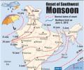
Southwest monsoon, the key to the agriculture driven trillion-dollar Indian economy, on Tuesday brought showers to Kerala bringing much-needed relief to farmers.

After becoming active over the rice-growing Indo-Gangetic plains, the southwest monsoon might witness weak phase for the next 3-4 days over the already rain-deficient region. So far, the main deficit states are Uttar Pradesh (-42 per cent), Bihar (-36 per cent), Jharkhand (-48 per cent), and West Bengal (-24 per cent). According to private weather forecasting agency Skymet, rains in west UP, Punjab, Haryana, Bihar, and Jharkhand are expected to be weak in the next 3-4 days before again picking pace.

Data from department of agriculture showed that kharif crops had been sown in around 31.56 million hectares till Friday, which was 104.25 per cent more than the same period last year. Acreage of almost all crops was higher than last year.

However, it's too soon to see any trend; July rain is key.
It is expected to advance into coastal and south-interior Karnataka during the next two days.
Normally, the monsoon hits Kerala on June one after which it spans the entire country up to Rajasthan.
